Demystifying The Metric Tensor in General Relativity
TLDRThis video script from 'Dialect' demystifies the concept of the metric tensor, a pivotal element in general relativity. It explains how the metric tensor, likened to a 'fancy bar scale,' quantifies space-time curvature due to matter and energy. Using topographical maps as an analogy, the script illustrates how metrics and tensors help in translating map distances into real-world measurements, accounting for terrain variations. The explanation extends to higher dimensions, emphasizing the tensor's role in mapping and understanding the geometry of our universe.
Takeaways
- 📏 The metric tensor is a mathematical object that describes the geometry of space-time in the context of general relativity.
- 🌍 The concept of a metric tensor can be understood through cartography, where a map's bar scale serves a similar purpose in converting map distances to real-world distances.
- 📉 A map's metric changes depending on the terrain's curvature, requiring adjustments to the bar scale to account for elevation changes and steepness.
- 🗺 Topographical maps use contour lines to encode varying metrics, indicating elevation changes and helping to calculate actual distances traveled.
- 📐 The metric tensor generalizes the concept of a bar scale to higher dimensions, requiring more components to describe the geometry of spaces with more dimensions.
- 📈 The accuracy of the metric tensor increases as the regions considered become smaller, allowing for a more precise description of the curved surface.
- 🔍 The metric tensor treats coordinate systems and the surfaces they describe as distinct, which is crucial for understanding the concept of curvature.
- 📊 In two dimensions, three numbers are needed to characterize the metric at each point, while in three and four dimensions, six and ten numbers are required, respectively.
- 🧭 The metric tensor is involved whenever a map is used to represent one surface by another, which is fundamental in the theory of general relativity where space-time is represented as a four-dimensional map.
- 🌌 For navigating extreme environments like black holes, a four-dimensional map, or understanding of the metric tensor, is necessary to account for the complexities of space-time curvature.
- 🔑 The metric tensor's components can be thought of as the sides and angles needed to determine the length of the diagonal of an n-dimensional parallelogram, providing a geometric interpretation of its role.
Q & A
What basic mathematical concept did the speaker use to determine their distance from the destination?
-The speaker used the concept of a bar scale from a map to determine the distance, where one inch equals half a mile. Measuring two inches on the map, they concluded they were one mile away.
What is the metric tensor, according to the script?
-The metric tensor is described as a mathematical object that assigns a bar scale to each piece of a map, converting coordinate distances to real-world distances, and is crucial in the theory of general relativity.
How does the metric tensor relate to general relativity?
-In general relativity, matter and energy alter the metric of space-time, resulting in a four-dimensional curvature synonymous with gravity. The metric tensor characterizes this curvature at each point in space-time.
What analogy is used to explain the concept of the metric tensor?
-The analogy of a bar scale on a map is used, where the metric tensor functions to convert coordinate distances on the map to real-world distances, similar to how a bar scale converts inches or centimeters on a map to miles or kilometers on the ground.
Why does the value of the metric change in different locations on a map?
-The value of the metric changes because the topography of the terrain affects the real distance. In hilly or mountainous areas, additional vertical distances must be traversed, altering the metric from the flat terrain ratio.
How do contour lines on a topographical map represent the metric?
-Contour lines indicate changes in elevation. Crossing contour lines on a map requires accounting for vertical distance changes, which, combined with horizontal distance, give the total distance traveled, reflecting the metric's variation.
What mathematical process is used to create a map from a curved surface like the Earth?
-The process involves dividing the curved surface into small, nearly flat pieces, cutting them apart, and then stretching and skewing these pieces to fit together on a flat surface. This involves assigning new scales and angles to the coordinates.
How are stretching and skewing operations described mathematically?
-Stretching assigns a new scale to coordinate intervals, while skewing turns coordinate squares into parallelograms and right triangles into obtuse or acute triangles, requiring three numbers to calculate distances accurately.
Why do we need more than one number to characterize a metric in higher dimensions?
-In higher dimensions, we need additional numbers to account for each dimension's stretching and the angles between them. For example, in three dimensions, six numbers are needed, and in four-dimensional space-time, ten numbers characterize the metric.
What is the significance of the separation between coordinate systems and manifolds in the metric tensor framework?
-The separation is crucial because it allows for describing different coordinate systems on the same surface or manifold, leading to the concept of curvature. It helps in understanding how the metric tensor applies in various contexts, such as converting Cartesian to polar coordinates.
Outlines
🗺️ Understanding the Metric Tensor Through Cartography
This paragraph introduces the concept of the metric tensor by drawing an analogy with map reading. It explains how a map's bar scale, which converts map distances to real-world distances, is akin to a metric. The paragraph uses the example of a hiker using a map to determine distance, and then delves into how the metric tensor is integral to general relativity, describing how matter and energy warp space-time. The explanation includes the idea that the metric tensor is a mathematical object with ten components that define the curvature of space-time at every point.
📏 The Role of the Metric in Mapping and Topography
The second paragraph explores the concept of a metric in the context of topographical maps, using a military-grade map of Fort Rucker, Alabama, as an example. It discusses how the map's bar scale represents the metric, converting distances on the map to actual distances on the ground. The paragraph explains how the value of the metric can change depending on the terrain's curvature, and how contour lines on maps encode varying metrics to account for elevation changes. It also touches on the process of creating accurate metrics by dividing the map into smaller pieces, each with its own bar scale, and summing these to determine actual distances traveled.
🌐 Generalizing the Metric Tensor for Higher Dimensions
The final paragraph extends the discussion of metrics to higher dimensions and more complex coordinate systems. It explains how the metric tensor generalizes to include additional components for each new dimension, accounting for both stretching and skewing of coordinate intervals. The paragraph uses the process of map-making, where a curved surface is transformed into a flat map, to illustrate how the metric tensor's components are determined. It concludes by emphasizing the distinction between coordinate systems and the surfaces they describe, highlighting the importance of this distinction for understanding curvature in general relativity.
Mindmap
Keywords
💡Metric Tensor
💡General Relativity
💡Space-Time
💡Curvature
💡Coordinate System
💡Map's Metric
💡Contour Lines
💡Topographical Map
💡Robinson Projection
💡Manifold
💡Curvature Distortion
Highlights
The concept of the metric tensor is crucial in the theory of general relativity, describing how matter and energy alter space-time.
A metric tensor is a mathematical object that characterizes the metric at every point across space and time with ten numbers.
The metric tensor can be intuitively understood through the analogy of a map's bar scale, which converts map distances to real-world distances.
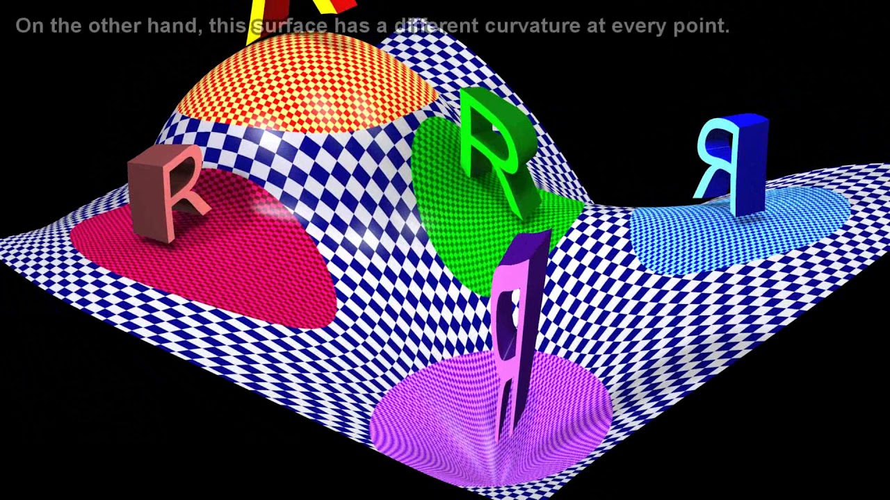
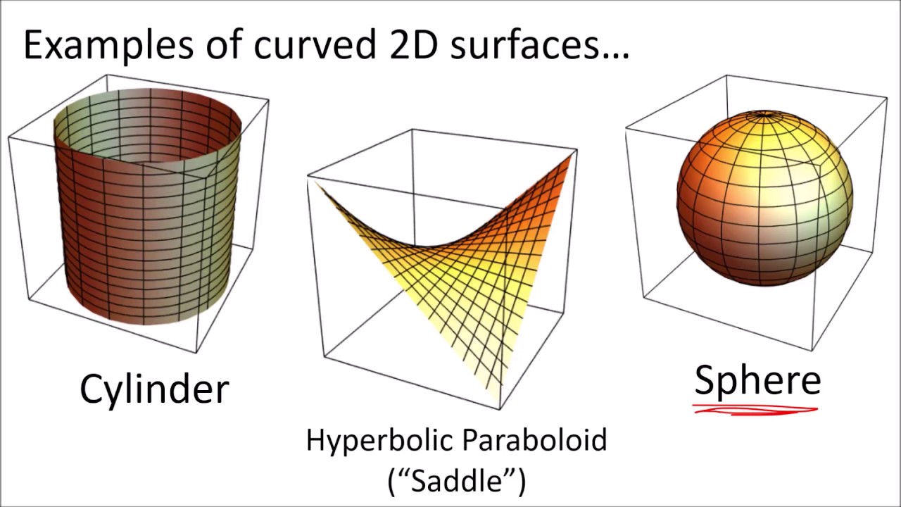
The value of a metric changes depending on the terrain's curvature, necessitating a tensor for more precise measurements.
Topographical maps use contour lines to encode varying metrics, indicating elevation changes and their impact on distance calculations.
The metric tensor generalizes to higher dimensions by adding components for each new dimension and angle between dimensions.
In two dimensions, three numbers are needed to characterize the metric, while in four dimensions, like space-time, ten numbers are required.
The metric tensor treats coordinate systems and the surfaces they describe as distinct, allowing for different metrics on the same manifold.
Maps, including those of the earth, use projections that distort distances and angles, requiring a metric tensor to account for these distortions.
The Robinson projection is highlighted as an example of a map that distorts both distances and angles.
The process of creating a map from a curved surface involves cutting, stretching, and skewing pieces to fit them onto a flat surface.
The operations of stretching and skewing are mathematically described by the metric tensor, affecting how coordinates are scaled and oriented.
The metric tensor's components can be thought of as the sides and angles needed to determine the length of a diagonal in an n-dimensional parallelogram.
The metric tensor is essential for understanding the representation of one surface by another, such as mapping a black hole's four-dimensional space-time.
The video 'Dialect' aims to demystify the metric tensor, providing a deeper understanding of its role in modern geometry and general relativity.
The metric tensor's practical applications extend beyond theoretical physics, with implications for cartography and navigation.
Transcripts
Browse More Related Video
Einstein's Field Equations of General Relativity Explained
Tensor Calculus Lecture 8e: The Riemann Christoffel Tensor & Gauss's Remarkable Theorem
General Relativity Lecture 4
Tensor Calculus 12: The Metric Tensor in Curved Spaces for Measuring Arc Length
General Relativity Lecture 2

The Mathematics of our Universe
5.0 / 5 (0 votes)
Thanks for rating: